Presented by
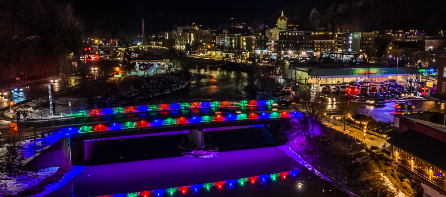
Montpelier AliveWelcome to the Montpelier's bridges tour! Bridges are among the most significant architectural features of a city. Once utilitarian structures, they have been transformed through the magic of light!
EXPLORE
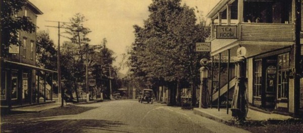
The interactive map offered on BaladoDiscovery will take you on a tour of Montpelier's historic downtown bridges. Through archival and contemporary photographs, you will learn about the role each bridge has played in the history of Montpelier, their engineering and construction, their relationship to the rivers and flooding, and the lighting design created for them.
ON SITE
This tour is best experienced at dusk, when you can see the bridges both during the day and illuminated at night. It will take you along the Winooski River, through the Capitol district and historic downtown. A route is suggested and your location is displayed in real time.
OPTIMIZED EXPERIENCE
It is recommended that you download the BaladoDiscovery app to your cell phone or ipad and then use the Preload option offered for this tour. You will then have full access to the tour offline from any location.
The City of Montpelier welcomes you and hopes you enjoy this experience!
CREDITS
Created by Vivian Ladd Tomasi, Coordinator, Montpelier Alive Bridge Illumination Project, and Paul Carnahan, Montpelier Historical Society, with contributions from Kassia Randzio, Development and Operations Director, Vermont River Conservancy.
SPECIAL THANKS
Michele Braun, Executive Director, Friends of the Winooski, Ned Swanburg and Jon Copans, Montpelier Commission for Recovery and Resilience, the Vermont Historical Society for historical images, Storyworkz, Jeb Wallace-Brodeur and John Lazenby for the use of their photography, Abena Songbird, (Missisquoi Abenaki), Lucy Cannon Neel (Nulhegan Abenaki), Uncle Erok, Carolyn Shapiro, Marguerite Houle (Ojibwe), with daughters, Rainy & Rosie Melchor (Cochiti/Diné/Ojibwe), and Rhonda Besaw (Abenaki Descent, Métis) for the use of their painting, Nd’ôlemôwzibna, (We Continue To Live), and LMNOPI for her mural, Quietness. Contemporary photograph of Main Street bridge © Wellesenterprises and Montpelier State House © Victorian, Dreamstime.com. Montpelier Alive’s Bridge Illumination Project was supported in part by the Better Places Program, administered by the DHCD in partnership with the Vermont Community Foundation and Patronicity, VT Flood Response and Recovery Fund of the Vermont Community Foundation, The Transformational Tourism, Events, and Regional Marketing (T-TERM) Grant Program administered through the Economic Development Administration (EDA), the Vermont Arts Council and the National Endowment for the Arts, Community National Bank, Union Mutual, LaFaso Electric, the City of Montpelier and the generous support of the community.
Produced by Montpelier Alive, 2025.


Comments
Montpelier Bridge Illumination Tour